Hyderabad speeds up drainage mapping to curb flooding
09-11-2025 12:00:00 AM
The mapping project is expected to serve as a foundation for a more systematic flood management plan ahead of the next monsoon season
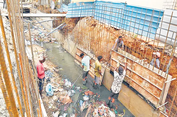
In the wake of recent heavy rains that left several areas of Hyderabad waterlogged, the Greater Hyderabad Municipal Corporation (GHMC) has accelerated efforts to find a long-term solution to urban flooding. Acting on state government instructions, GHMC has launched a detailed mapping of all stormwater channels within the city and across the Telangana Core Urban Region.
Officials had earlier identified nearly 1,013 kilometers of small, medium, and large drainage lines. According to officials, around 731 kilometers have already been mapped by the GHMC IT Wing, and the remaining stretches are expected to be completed by the end of next month. Once finished, GHMC will prepare a comprehensive “Stormwater Drainage Master Plan” using the collected data.
The civic body is also studying flood management systems in cities such as Mumbai, Gurugram, and Bhopal to adapt effective practices for Hyderabad. A “proof of concept” project has already started in the Karwan area under the Khairatabad Zone, modeled on Mumbai’s system. Initial surveys revealed that flooding in many low-lying areas is mainly due to encroachments that have narrowed natural stormwater channels, restricting the flow of rainwater. To document the situation accurately, GHMC teams are conducting both ground-level and drone-based surveys to compare the original and current dimensions of these channels.
For technical assistance, GHMC is using a mobile field application developed by ESRI to identify stormwater drains, lakes, and underground utilities. The survey is being carried out under the supervision of an Assistant Executive Engineer in each ward. It will also assess the feasibility of linking the city’s chain of lakes and diverting surplus rainwater into the Musi River.
According to officials, each stormwater manhole will be assigned a unique identification number to improve monitoring and maintenance. The mapping project is expected to serve as a foundation for a more systematic flood management plan ahead of the next monsoon season.