Hyd braces for intense rainfall: Red alert issued for TG districts
27-09-2025 12:00:00 AM
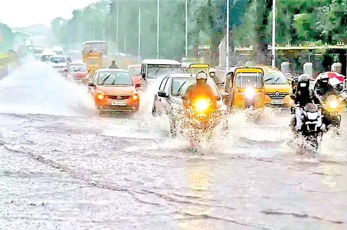
Hyderabad is on High alert of heavy rains for the next 5 days as per the India Meteorological Department’s (IMD) report issuing a series of weather alerts for Telangana as the southwest monsoon intensified. Cautions escalate for the residents to be prepared to isolate due to extremely heavy rainfall across the state with several districts having higher alert levels.
The situation is expected to peak specifically on September 27th and 28th. According to the Senior Meteorologist at IMD, Srinivas Rao said that an extreme rainfall is expected in districts like Vikarabad and Sangareddy with a high red alert. Meanwhile, orange warnings remain in effect for several northern and southern districts and yellow alerts in Hyderabad and other districts. Districts including districts, including Nirmal, Nizamabad, Jayashankar Bhupalapally, Mulugu, Bhadradri Kothagudem, Mahabubabad, Warangal, Hanamkonda, Jangaon, Siddipet, Medak, Kamareddy, Mahabubnagar, and Nagarkurnool, are forecast to experience heavy to very heavy rainfall at isolated places.
Urban Hyderabad is to expect cloudy skies with scattered intense spells that could trigger flooding in low-lying neighborhoods and slow traffic across major roads. Specifically in Hyderabad, residents are being warned to be braced for generally cloudy skies with moderate to heavy rain and thundershowers. The IMD has also cautioned of thunderstorms followed by strong gusty winds, reaching 40–50 kmph, across all the districts of Telangana. Heavy downpour could trigger blockages, major traffic snarls, and power supply disruptions in multiple areas of the capital city. Officials noted that the southwest monsoon has been an over Telangana, with recent heavy rainfall already reported in Jangaon, Medak, Sangareddy, Vikarabad, and parts of Bhupalpally, Karimnagar, Mulugu, Nalgonda, and Yadadri Bhuvanagiri. Municipal bodies have been advised to show the alerts notably and accelerate the clearance of pooled water. Road, rail, and air traffic departments have been recommended to regulate traffic flow, while emergency response teams stand by to tackle possible flooding and uprooted infrastructure.
Apart from this, meteorologists warn that the present low lying areas over the northwest Bay of Bengal is expected to escalate into a depression and make landfall near the South Odisha–North Andhra Pradesh coast on the morning of September 27.
With the weather forecasts pointing towards the next weekend to be turbulent with intense downpours, Hyderabad and surrounding districts are urged to remain on the high alert. Residents are advised to follow certain practical steps such as avoiding driving specifically across the low lying areas, stocking basic supplies to avoid stepping out, move vehicles off low spots and follow local civic updates.